This seems to be a fairly common treatment – the local street doesn’t connect to the busy street for autos, but easily connects for walking and bicycling so residents can access the walk/bike network and transit stops.
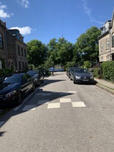
This is another common local street design – speed humps and on-street parking. The widths of local streets vary but often have sidewalks, on-street parking, and traffic calming.
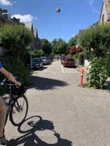
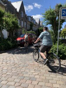
This is an example of a higher level of traffic calming. Driving on this street is allowed, but at a slower speed.
The local street isn’t connected to the arterial – there is a walking and biking route though so residents have quick and easy access to the bike network, shopping, restaurants, and transit. There is parking both sides, and a shared space for traveling. There are sidewalks as well.
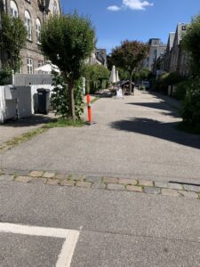
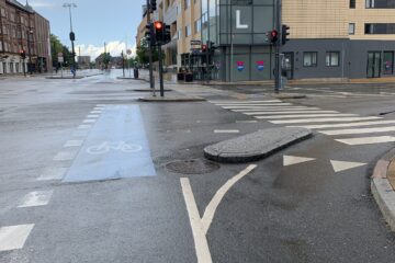
This is a photo of a driveway apron that connects the local street to the busy street. The cobbles and narrowed entry provide visuals and texture to help anyone driving enter the neighborhood zone slowly.
This is the edge of the cobbled driveway apron to the street. It has a matched elevation, no lip, but is definitely rough that makes people slow down.
Copenhagen planning and public works departments work to create community whenever they can. The overriding principle is to ensure people are happy, can connect with neighbors, feel a strong sense of belonging and safety. The ambition to ensure that neighborhoods are protected spaces that create security is seen through how much effort is put into making sure residential areas have parks, playgrounds, schools, and traffic moves at a people centered speed. We visited with Jan Gehl Architects and were able to talk to Andreas Rohl. He used to work for the City of Copenhagen for many years before working for this consulting firm. He used to run their Mobility and Public Space Planning Department. It is an interesting mix of department specialties, but as he explained, 80% of the common spaces in our communities are rights-of-way. Using this space to connect people and places is just one of its roles in Copenhagen. They also make sure the space connects people to other people and provides strong sense of community. He notes that most communities just see right-of-way through the first lens – connecting people and places.
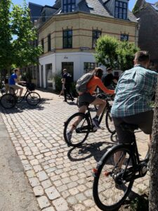
There are a few residential streets we’ve noticed that have traffic calming like this, where you can drive through but only at a very slow speed. The street is mainly used to create a community connection between the homes, so that the street does not divide people but brings them together, to give them a common gathering space, place for the kids to meet, and older neighbors to feel involved and active. The hedge creates a private space for the residents too.
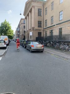
We’ve seen a few of these. The busy street has a kind of mild frontage street, where on-street parking can be provided. Instead of the protected bike lane, the people on bikes are routed through this frontage area. The only purpose is really to access parking, so the route is still comfortable as speeds are slow and cars are few.
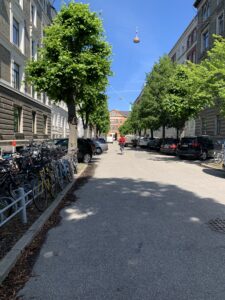
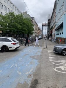
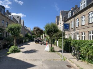
It is common to provide parking for bikes and cars on streets. This residential street has a significant number of parked bikes and a few cars are accommodated in angled parking bays. The dimensions on this fit in a 60′ ROW. It has 6′ sidewalks, and 14′ parking on each side. There is 20′ between parked cars that is used for people driving and bicycling.
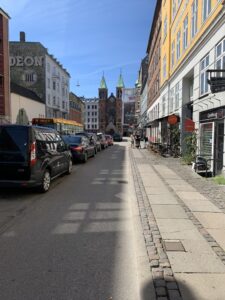
Commercial local street, has on-street parking on one side, and sidewalks on both sides.
1 Comment
David Green · July 11, 2022 at 2:59 am
I love the idea of a Department of Mobility and Public Spaces. A separate engineering department could provide technical expertise in support but the planning and intent of the spaces would more likely be people centered when administered by a department with that emphasis.