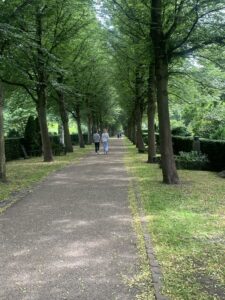
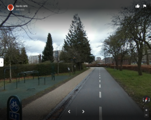
The City worked to create a path through a cemetery to complete an important walk/bike connection.
The City created walking streets where residents can shop without traffic. These streets are important community building areas where folks can be social and serve people of all ages, income levels, and ethnicities.
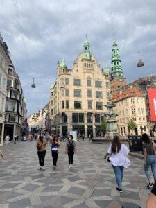
Walking streets in shopping areas play an important role in social life in Copenhagen. Carfree areas provide a safe way to shop. No bikes allowed on these walking streets.
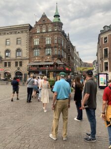
Families, teens, young adults, older folks all walk through this area to dine and shop. The walking only shopping streets add miles of walking routes and create community gathering places, places for art, water fountains, and form a focal point for the community.
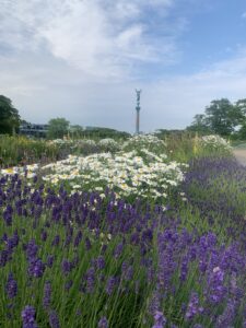
Statues and art as well as wildflowers and unpaved paths are common. Stormwater management is a key aspect in park design (and roof design).
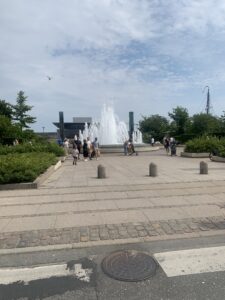
This fountain completes an important visual connection linking two public spaces.
Interestingly, the city of Copenhagen has a department that is Mobility and Public Spaces. They want to maximize how many residents can live close to work and services so they can attract and retain a high quality workforce while also reducing VMT/increasing walk/bike/transit mode usage. So they knew they were going to have to highly amenitize their community and create a high-quality, dense walking and bicycling network and create an amazing transit system.
Interesting things this department works on:
Playgrounds
One program’s aim is to build playgrounds. Key features of playgrounds that we’ve noticed – there are lots and lots of them – some small and some large, most are fully enclosed with fencing. Kids are safe. Free from harm. This is a big motivator to folks here. Their children are their life-long projects, and they want to allow them to play and be safe. Playgrounds are close to homes. Most new and old housing we’ve explored all have playgrounds right in the middle of the complex. The City codes require playgrounds with development, and for any residential areas that are missing playgrounds, the city plays an active role in bringing new playgrounds on line each year in close proximity or within neighborhoods.
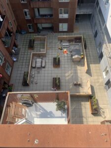
Example of a playground in Norrhaven neighborhood – it is in the middle of the apartment building so all apartments in the building have access to it and can see the kids playing. This shot is taken from the rooftop garden.
One fun playground type here is a Staffed Neighborhood Park – I relate it to a swimming pool back home – there are staff there that watch the kiddos and can engage in play – but it is not daycare – Parents can let the kids go to the playground and be somewhat supervised. There are staff who are there and can help if needed.
This helps create community and improve relationships – gives neighbors a chance to meet each other and make friends. The aim is to improve livability and community.
The staff are city employees.
Kindergartens
There is private and public childcare in Copenhagen, just like in Bend. If it is public childcare, the childminders, as they are called here, are also municipal employees. Every child in the city is guaranteed a space in a public kindergarten – it seems different than elementary school as there are fees associated with the kindergarten. This is an important service for residents because it helps the City meet its economic and family-centered goals. It allows families to be more fully engaged in the workforce as these kindergartens are within each neighborhood, so kid drop off and pick up are convenient.
The city also works to create schools near where people live.
Negotiated Public Open Space
Another program they have is directed to create shared space. The city staff actively engage private property owners in nearby apartment buildings and work to create really nice public space between the buildings. They present ideas, show before and after photo examples, provide lists of architects and planners, and contractors. The City will fully fund the efforts, but the neighborhood has to work through the process and agree to work together. The goal is to improve quality of life for residents to be able to stay in town, and not move to neighborhoods that might be further out (keep commute times short and trip lengths bike-able).
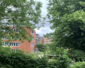
Image shows space between buildings (in the distance since photo was taken from far away) can be converted to shared open space thru agreement.
Greenways
This is a network of former railways that has been converted to linear parks and trails. Here is one image. They are great ways to connect people and places, provide space for parks and playgrounds, open space, and provide a nice, easy place to ride. The greenways play an important role in stormwater management. These old rail lines are in town, but also finger out into the suburbs. Width standards are flexible and the further out from the city center they run, the narrower their widths can be. One rail trail between Faaborg and Odense runs almost 28 miles, and is just 5′ wide the whole way – it is very rural, and serves people walking, on scooters, bikes, and mopeds.
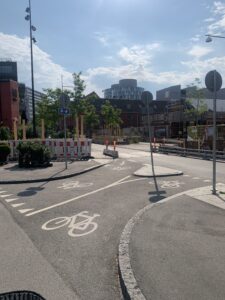
This shows a striped two-way bike path adjacent to a separate walking/running track. The bikeway is paved asphalt, and the walkway is crushed aggregate.
New Developments are Amenitized, and Linked to the Full Transportation Network
It is vitally important that new developments are brought online so they can create commuting habits from day 1, not years later. With the opening of Phase 1, Copenhagen requires roads, protected bike lanes, transit stops, and Metro Line stops are extended to the new development. We talked to residents of Norrhaven and they moved in with Phase 1, 7 years ago. The Metro line and bus stops and protected bike lanes were usable for them. The developers sometimes pass the costs onto the residents with an annual surcharge. They are paying a small amount each year to the Metro District for the expensive Metro Rail Line and Station that was built near their property. The distance was 1/4 mile – all residents within the 1/4 mile pay the surcharge. The surcharge is put on their apartment complex fees and will last for 100 years, so the surcharge runs with the unit. They didn’t mind because being close to light rail and on the bicycling network boosts the value of their home more than others.
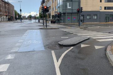
Norrhaven: New street connection to new neighborhood prioritizes bike connection over the auto connection. Auto connection still exists, but front and center is the bike connection to the protected bike network.
Development is required to pay for Metro Rail line connections and extensions. The residents pay an annual tax to Metro. Speaking to Norrhaven residents, the tax runs with the property and will expire in 100 years. It is not negotiable – every apartment pays. Metro must extend the line at the start of the development, Phase 1, so that residents build the commuting habits from the start.
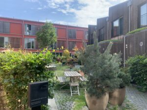
Shows an example of public and private spaces in an apartment neighborhood. The large open space encourages social life, while protected balconies and patios allow private family time.
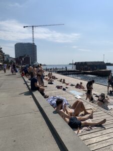
The first 50 metes of all waterfronts are public, and abutting developments are required to create public accesses through their developments to the public space. This is an example of a new community amenity – a swimming and bathing area abutting Norrhaven development – developer created the waterfront park, but it is open to the public.
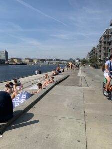
this photo shows the line between public and private property – but even the private property is required to have a public access easement.
B
1 Comment
David Green · July 11, 2022 at 3:13 am
We could easily make the Old Mill car free, and what an experience that would be. It just needs a good bike/ped connection to down town and across the parkway on Colorado and Wilson. And down town could be much more car free with parking management and a better traffic pattern. I’d even go downtown to shop if it were.