As City’s grow, it is sometimes necessary to spread into adjacent rural areas. In Oregon, the Urban Growth Boundaries slow this process and help ensure city’s can grow up before they need to grow out into vital farmland and forestland.
We were able to see one area that is rapidly growing on the western edge of Utrecht. Transportation Planner Ronald Thamse shared how important it is to make sure we extend transportation systems (walk, bike, train, and bus, as well as drive routes) into new developments on the urban fringe. He showed us one urban expansion beyond the traditional limits of this ancient city, Utrecht, Netherlands.
There are 3 highways that almost completely enclose Utrecht. But Utrecht is expanding beyond those highways into areas that just a few short years ago were small villages and farmland. We looked at maps, and biked two new bridges the City has built to connect a new neighborhood on its western fringe.
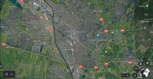
This map shows Utrecht with highways to the east, west, and south of the town. https://earth.google.com/web/search/utrecht/@52.08451115,5.10839638,5.51644011a,15272.26090519d,35y,0h,0t,0r/data=CigiJgokCdT4Aq57CzhAEdP4Aq57CzjAGWz8QuelzTBAIeH25rgvgFbA
The highway on the west (left side of the image) runs north and south. You can see the highways as yellow lines with red boxes. That is the A2 highway. You can see the density of Utrecht in the middle of the photo, and then farmland around the edges, beyond the highways.
The neighborhood now called Parkwik continues to urbanize and is an incredibly important area to accommodate much needed housing for the City of Utrecht. This area is only 3 miles from the center of Utrecht – incredibly close. As the neighborhood was urbanizing, families realized that they needed more parks, more schools, and easier ways to reach the many jobs and cultural amenities in the center of Utrecht. Worse yet, the fastest growing area for jobs in Utrecht is actually located on the east side of Utrecht – at the hospital area and university area. So this new neighborhood not only needed to get across the highway and the canal, they needed to be able to cross the heart of Utrecht (think major roadway congestion through the downtown core) to get to the high paying jobs. While driving was about the only option, it was not a pleasant commute and residents complained greatly.
This area to the west of the A2 was just poorly connected to the main part of the city as it was blocked by the A2 highway as well as a substantial canal. The canal is the main shipping canal for the country so it is wide also and creates another barrier to connecting to the heart of Utrecht.
The national government wanted to widen the A2 to 10 lanes because it is an important N-S highway that carries lots of traffic. But Utrecht planners thought this would further separate this new neighborhood and make it harder to ensure transit and biking systems could connect and be easily incorporated into the transportation mix for the area. So they buried it instead – it now has a concrete cap over the highway and there is parkland on top. The transportation system now criss-crosses the highway readily and creates better connectivity. They did this same type of facility for the A2 down south in Maastricht (there the tunnel is double decker).
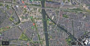
The A2 adjacent to Utrecht now is underground for 1 mile and acts as a greenbelt.https://nl.wikipedia.org/wiki/Leidsche_Rijntunnel
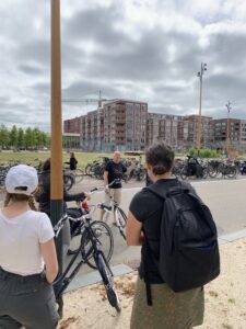
You can see the flat area to the left of the buildings – that is the cap of the 10-lane A2 motorway – green space but no buildings over the tunnel.
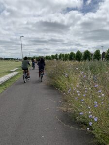
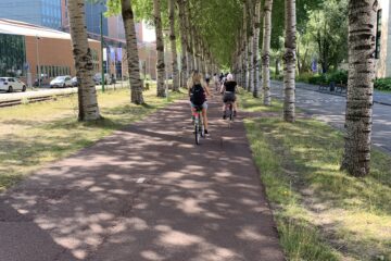
The undergrounded highway allowed a linear park with shared use path to be constructed on top.
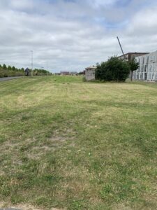
Greenspace on top of the buried highway.
There are now parks, open space, native flowers, and much housing construction.
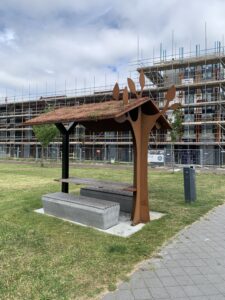
This image shows that some of the greenspace is slowly being refined from just green turf into parkland. This creative picnic shelter has a green roof, artistic supports. There are lots of playgrounds and soccer fields, etc. but I apparently didn’t catch any of them on film! You can see new apartment building under construction. We could see 4 cranes operating in the area – so the new developments are in full swing.
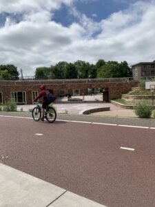
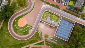
Creative financing, creative use of land: Utrecht partnered with the school district to share costs – the new neighborhood of Parkwik needed a new school and it needed new biking connections to the many cultural amenities in the heart of Utrecht (as well as jobs). So they partnered – this is a school built right into the land that is being used for ramping the wide two-way bike facility around and up onto the new bridge that connects this growing neighborhood across the canal.
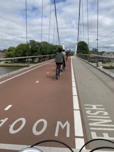
Utrecht built two new bridges – this is the Daphne Schippers Bridge. Named after a world class Dutch Sprinter. Playfully, there are 100 meter and 200 meter distances marked out on the bridge deck.
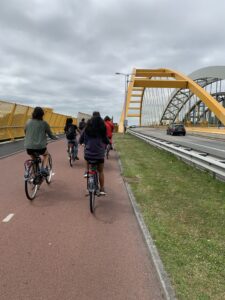
This is the other new bridge built to better connect the neighborhood west of the core of Utrecht. It has a wide two-way bikeway and sidewalk in addition to two lanes for cars. There is a rail bridge next to it that carries light rail to the new neighborhood.
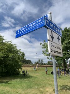
New parkland, and the sign for the new Dafne Schippers Bridge.
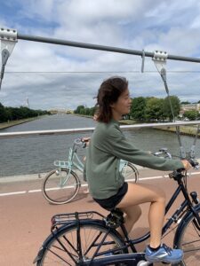
Bike riders enjoy the new Dafne Schippers Bridge. You can barely see the other bridge – the yellow one – in the background, that was also built to connect bikeways into the new neighborhood west of the core of Utrecht.
Lessons Learned – that Bend can learn from
Ronald lamented that they got some things wrong with this new community expansion area. He and his staff would have preferred that the new development felt more strongly connected to the rest of Utrecht – one city rather than a separate area.
They didn’t extend transit, commuter rail, or biking facilities during phase 1 of the development. This allowed driving to become the dominant form of transportation and subsequent congestion and pollution followed. – the new neighborhood is just 3 miles (pinpoints from the middle of new neighborhood to middle of downtown Utrecht – so many new homes are actually more like just 2 miles away). They are now retro-fitting better connections in by extending commuter rail lines, and have built two new bridges for walking/biking to finally connect the two parts of the community back together.
They didn’t require new schools to be part of the development. So there is a strong need for new schools. They had to get creative to fit one in as they built one of the new bridges.
As Bend grows into our Urban Growth areas east and south, for example, making sure comfortable walking, biking, and transit connections, schools and parks are built to make sure the new neighborhoods are woven right into the fabric of the rest of the community. Connections that serve all ages and all abilities will ensure a feeling of one community.
0 Comments